


Northern RI – Those hoping for the end of winter shouldn’t put away their shovels just yet, as the season’s largest storm is set to roll into the region Sunday night.
The National Weather Service has issued a winter storm watch for all of Rhode Island, predicting 12-18 inches across the state.

The high impact winter storm is on track to bring blizzard conditions to the region, with strong winds and heavy snow.
Snow is expected to arrive Sunday afternoon and increase through the evening with the heaviest coming after 10 p.m. Accumulation is on track to continue into Monday afternoon, with rates of more than two inches per hour.
“Whiteout conditions are possible and may make travel treacherous and potentially life-threatening,” noted NWS, adding that visibility could drop to less than 1/4 mile.
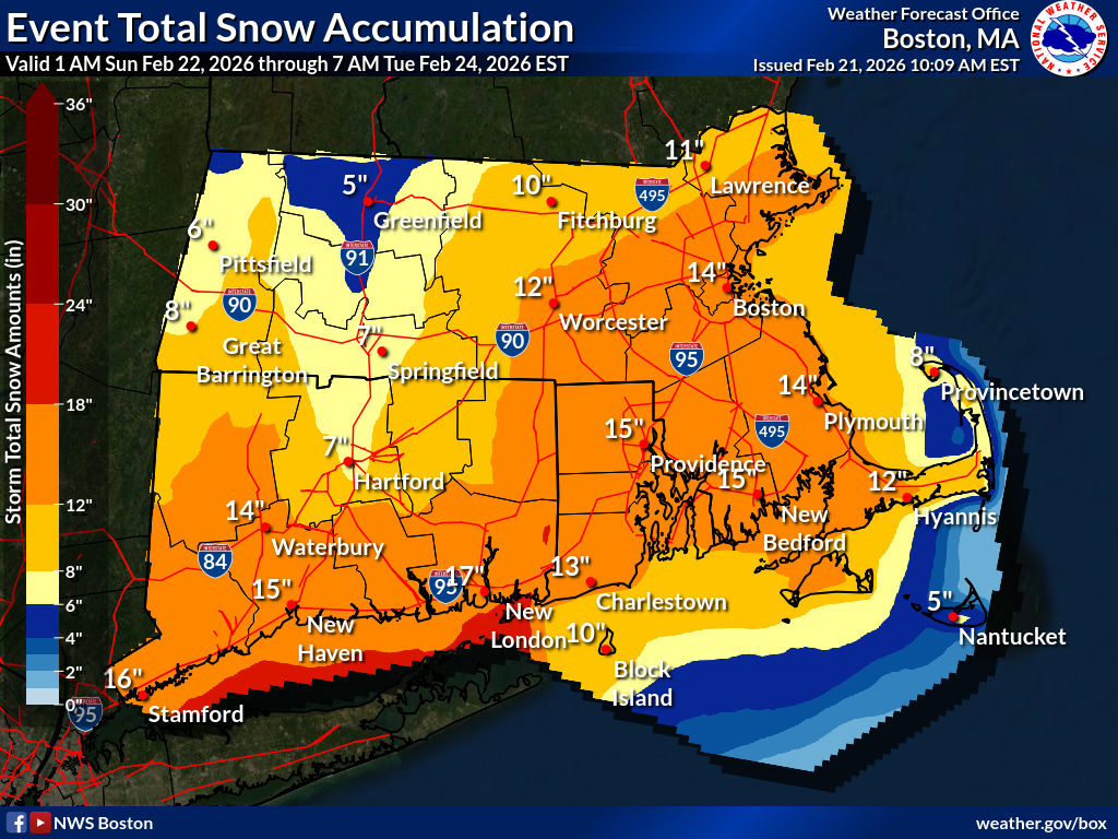
The storm will also bring wind gusts of 40 to 60 miles per hour, and the heavy wet snow and blizzard conditions could create the potential for power outages, according to the agency.
On Saturday, the weather service noted “high confidence” in accumulation of 10-20 inches across eastern Massachusetts and Rhode Island
The winter storm watch remains in effect until Tuesday morning.

The post National Weather Service warns of high impact blizzard Sunday night into Monday first appeared on NRI NOW.
